Uzbekistan - Asia

Uzbekistan facts & history in brief
Tashkent
Excerpted from Wikipedia, the free encyclopedia
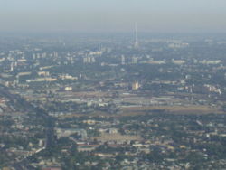 Tashkent - Aerial view
Tashkent is the capital of Uzbekistan
and also of the Tashkent Province.
The officially registered population of the
city in 2006 was 2.1 million.
According to unofficial data, the
population is more than 3 million.
In medieval times the town and the province
were known as "Chach".
Later, the town came to be known as
Chachkand/Chashkand, meaning "Chach City."
(Kand, qand, kent, kad, kath, kud--all
meaning a city, are derived from the Old
Persian, kanda, meaning a town or a city.
They are found in city names like
Samarkand, Yarkand, Penjikent etc.)
After the 16th century, the name was
steadily changed slightly from
Chachkand/Chashkand to Tashkand,
which, as "stone city", was more
meaningful to the new inhabitants
than the old name.
The modern spelling of Tashkent
reflects Russian orthography.
Geography
Tashkent is located 41°18'N, 69°16'E
in a well watered plain to the west
of the last Altai mountains on the
road between Chimkent and Samarkhand.
Tashkent sits at the confluence of the
Chirchik river and several of its
tributaries and is built on deep
alluvial deposits (up to 15 metres).
It is a lively tectonic area suffering
large numbers of tremors
and some earthquakes.
One earthquake in 1966 measured 7.5
on the Richter scale.
The local time in Tashkent
is UTC/GMT +5 hours.

For a more information about
Tashkent see Wikipedia, the free encyclopedia

This page was retrieved and condensed from
(http://en.wikipedia.org/wiki/Tashkent)
see Wikipedia, the free encyclopedia, March 2008.
All text is available under the terms of the
GNU Free Documentation License
(see
Copyrights for details).
About Wikipedia
Disclaimers

This information was correct in March 2008. E. & O.E.

2007
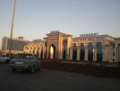
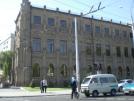
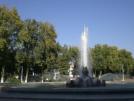
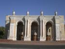
You can click on these photos for an enlargement.
 |
 |
 |
 |
| Tashkent |
Tashkent |
Tashkent |
Tashkent |
 |
 |
 |
 |
| Tashkent |
Tashkent |
Tashkent |
Tashkent |
 |
 |
 |
 |
| Tashkent |
Tashkent |
Tashkent |
Tashkent |
 |
 |
 |
 |
| Tashkent |
Tashkent |
Tashkent |
Tashkent |
 |
 |
 |
 |
| Tashkent |
Tashkent |
Tashkent |
Tashkent |
 |
 |
 |
 |
| Tashkent |
Tashkent |
Tashkent |
Tashkent |
 |
 |
 |
 |
| Tashkent |
Tashkent |
Tashkent |
Tashkent |
 |
 |
 |
 |
| Tashkent |
Tashkent |
Tashkent |
Tashkent |
 |
 |
 |
 |
| Tashkent |
Tashkent |
Tashkent |
Tashkent |
 |
 |
 |
 |
| Tashkent |
Tashkent |
Tashkent |
Tashkent |
 |
 |
 |
 |
| Tashkent |
Tashkent |
Tashkent |
Tashkent |
 |
 |
 |
 |
| Tashkent |
Tashkent |
Tashkent |
Tashkent |
 |
 |
 |
 |
| Tashkent |
Tashkent |
Tashkent |
Tashkent |
 |
 |
 |
 |
| Tashkent |
Tashkent |
Tashkent |
Tashkent |
 |
 |
 |
 |
| Tashkent |
Tashkent |
Tashkent |
Tashkent |
 |
 |
 |
 |
| Tashkent |
Tashkent |
Tashkent |
Tashkent |
 |
 |
 |
 |
| Tashkent |
Tashkent |
Tashkent |
Tashkent |
 |
 |
 |
 |
| Tashkent |
Tashkent |
Tashkent |
Tashkent |
 |
 |
 |
 |
| Tashkent |
Tashkent |
Tashkent |
Tashkent |
 |
 |
 |
 |
| Tashkent |
Tashkent |
Tashkent |
Tashkent |
 |
 |
 |
 |
| Tashkent |
Tashkent |
Tashkent |
Tashkent |
 |
 |
 |
 |
| Tashkent |
Tashkent |
Tashkent |
Tashkent |
 |
 |
 |
 |
| Tashkent |
Tashkent |
Tashkent |
Tashkent |
 |
 |
 |
 |
| Tashkent |
Tashkent |
Tashkent |
Tashkent |
 |
 |
 |
 |
| Tashkent |
Tashkent |
Tashkent |
Tashkent |

Site Index
Back to Top
Photos Index
Thanks for coming, I hope you
have enjoyed it, will recommend
it to your friends, and will come
back later to see my site developing
and expanding.
I'm trying to make my pages
enjoyable and trouble free for everyone,
please let me know of any mistakes
or trouble with links, so I can
fix any problem as soon as possible.
These pages are best viewed with
monitor resolution set at
800x600 and kept simple on purpose so
everyone can enjoy them across all media and
platforms.
Thank you.
Webmaster

|
