|
|
|
|
|
|
|
|
|
|
|
|
Korean Demilitarised Zone (1)Korea - Asia
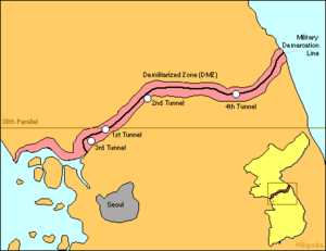
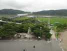
Map of the Korean DMZ. The DMZ is given in red. The demarcation line runs in the middle of the DMZ (black line). The DMZ cuts the Korean Peninsula roughly in half, crossing the 38th parallel on an angle, with the west end of the DMZ lying south of the parallel and the east end lying north of it. It is 155 miles (248 km) long and approximately 2.5 miles (4 km) wide, and is the most heavily armed border in the world. History Division of Korea The 38th parallel north - which cuts the Korean Peninsula roughly in half - was the original boundary between the UN-controlled and Soviet-controlled areas of Korea at the end of World War II. Upon the creation of the Democratic People's Republic of Korea (DPRK) and the Republic of Korea (ROK) in 1948, it became a de facto international border and one of the most tense fronts in the Cold War. 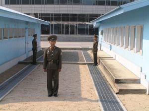
Panmunjeom, the Joint Security Area in the DMZ. View from the north. The conflict, which claimed over three million lives and divided the Korean Peninsula along ideological lines, commenced on June 25, 1950, with a Soviet-sponsored DPRK invasion across the DMZ, and ended in 1953 after international intervention pushed the front of the war back to near the 38th parallel. In the ceasefire of July 27, 1953, the DMZ was created as each side agreed in the armistice to move their troops back 2,000 metres from the front line, creating a buffer zone four kilometres wide. The Military Demarcation Line (MDL) goes down the center of the DMZ and indicates exactly where the front was when the agreement was signed. Since the armistice agreement was never followed by a peace treaty, the two Koreas are still technically at war. 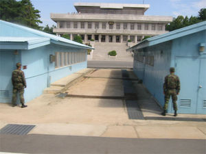
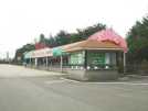
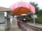
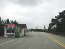
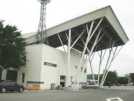
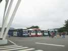
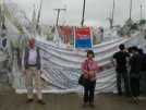
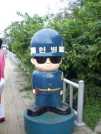
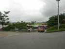
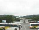
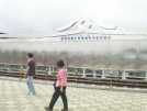
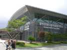
Joint Security Area, view from the south(1) The armistice agreement explains exactly how many military personnel and what kind of weapons are allowed in the DMZ. Soldiers from both sides may patrol inside the DMZ, but they may not cross the MDL. Despite these, sporadic outbreaks of violence due to North Korean hostilities has killed over 500 South Korean soldiers and 50 U.S. soldiers along the DMZ between 1953 and 1999. Joint Security Area Inside the DMZ, near the western coast of the peninsula, is a place called Panmunjeom, home of the Joint Security Area (JSA); it is the only place where North and South connect. 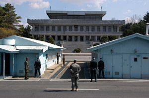
Joint Security Area, view from the south(2) The Joint Security Area is the location where all negotiations since 1953 have been held, including statements of Korean solidarity, which have generally amounted to little except a slight decline of tensions. The MDL goes through the conference rooms and down the middle of the conference tables where the North Koreans and the United Nations Command (primarily South Koreans and Americans) meet face to face. Though generally calm, the DMZ has been the scene of much saber-rattling between the two Koreas over the years. Several small skirmishes have occurred within the Joint Security Area since 1953. The Axe Murder Incident in August 1976 involved the attempted trimming of a poplar tree which resulted in two deaths and Operation Paul Bunyan. Before this time, the soldiers of both sides were permitted to go back and forth across the MDL inside of the JSA, a privilege since revoked as a result of this incident. Another incident occurred later when a Soviet dignitary, who was part of an official trip to the JSA (hosted by the North), ran across the MDL yelling that he wanted to defect. North Korean troops opened fire and chased him across the line. South Korean troops, protecting the defector, fired back and eventually surrounded the North Koreans. One South Korean soldier was killed in the incident. The defector expressed joy in his successful attempt but was saddened by the loss of life. Since this incident, the North Korean soldiers face one another so defectors cannot come upon them from behind. They are ordered to shoot anyone who attempts to defect before they reach the line. 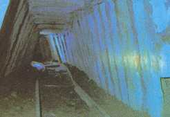
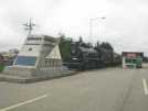
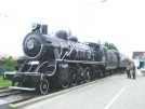
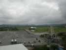
Incursion tunnel 1 Starting on November 15, 1974, the South discovered four tunnels leading under the DMZ. The first of the tunnels was discovered by a South Korean Army patrol, noticing steam rising from the ground. The initial discovery was met with machine gun fire from North Korean soldiers. Five days later, during a subsequent exploration of this tunnel, U.S. Navy Commander Robert M. Ballinger and ROK Marine Corps Major Kim Hah Chul were killed in an explosion triggered from North Korea, along with the wounding of six additional United Nations Command personnel, five American and one South Korean. This first tunnel was about three feet by four feet and extended over 1,000 meters beyond the Military Demarcation Line (MDL) which is the actual dividing line between North and South Korea. When the first tunnel was discovered, it was reinforced with concrete slabs, electric power and lighting, weapons storage and sleeping areas and had a narrow gauge railway with carts, capable of allowing approximately 2,000 soldiers per hour to traverse it. 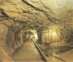
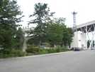
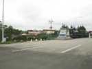
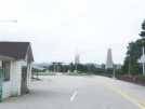
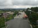
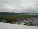
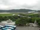
Incursion tunnel 2 The third tunnel was discovered on October 17, 1978. Unlike the previous two, the third tunnel was discovered following a tip off from a North Korean defector. This tunnel is about 1,600 meters long and about 150 meters below ground. A fourth tunnel was discovered on March 3, 1990. It is almost identical in structure to the second and the third tunnels. The tunnels were dug by North Korea and are presumed for use by the military as an invasion route. Each tunnel is large enough to permit the passage of an entire division in one hour. All the tunnels run in a north-south direction and do not branch off. The planning for the tunnels got progressively more advanced (for example, the third tunnel slopes upward slightly as it progresses southward, so that water does not stagnate). The orientation of the blasting lines within each one indicate that North Korea dug the tunnels. Upon their discovery, the North claimed that they were for coal mining; however, no coal can be found in the tunnels, which are dug through granite, but some of the tunnel walls were at some point painted black to give the appearance of coal. Today, it is possible to visit some of the tunnels as part of guided tours from the South. Some of the famous tunnel tours include the Third Tunnel of Aggression which was discovered in the 1970s. Current status Apart from Panmunjom, the Joint Security Area and two model villages, the DMZ is devoid of humans and their machinery, other than a large number of land mines. Both Koreas deploy the majority of their military personnel and technology within 100 miles (160 km) of the Military Demarcation Line that runs through the middle of the DMZ. This represents over one million troops on either side, plus large numbers of tanks, long-range artillery, and armoured personnel carriers. The DMZ is in many ways the last front of the Cold War. Villages Within the DMZ there are two villages: one run by the North and the other by the South. Both are located near the Joint Security Area. Daeseong-dong, found on the southern side of the DMZ, is a traditional village and strictly controlled by the South Korean government. For instance, one must have ancestral connections to the village in order to live there. These restrictions serve to keep the population of the village very small. In the North, Gijeong-dong, or as it is called in North Korea, "Peace Village," has only a small caretaker population. Through the armistice agreement the North felt that it should be allowed a town within the borders of the DMZ since the South already had one. UN troops call this Propaganda Village because only a small group of people cleaning and turning on lights reside within the village. Although from afar it appears to be a modern village, one can tell with binoculars that there is no glass within the windows of the buildings. In the past, North Korean propaganda was sent out by loudspeaker across to Daeseong-dong for as much as 20 hours per day, and reciprocal pop music and South Korean exhortations blasted back. These broadcasts ceased by mutual agreement in 2004. 
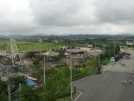
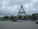
A portion of the northern boundary of the DMZ as seen from the Joint Security Area in January 1976 Buildings The North Korean building facing South Korea in the Joint Security Area is sometimes said not to be a real building but, "a facade designed to look large and impressive, in reality only a frame a few feet (1 m) thick. However, accounts from tourists having visited the northern side of the JSA have revealed that it is in fact a real building. Flagpole During the 1980s, the South Korean government built a 98.4 metre (328 ft) tall flagpole in Daeseong-dong. The North Korean government responded by building a taller one - the tallest in the world at 160 metres (525 ft) in Kijong-dong. Korean wall The Korean wall is a concrete barrier allegedly built along the length of the DMZ in South Korea between 1977 and 1979. The nature of the barrier is disputed, however it is widely accepted outside of North Korea that the wall does not exist. 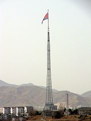
The tallest flagpole in the world, in Kijong-dong. It is set with wire entanglements and dotted with gun embrasures, look-outs and varieties of military establishments the South Korean rulers built this wall over a period of many years from 1977. They consumed over 800,000 tons of cement, over 200,000 tons of steel, and over 3.5 million cubic meters (123.6 million cu ft) of gravel and sand". As described by the DPRK the south side of the wall is packed with earth, which permits access to the top of the wall and makes it effectively invisible from the south side. North Korea claims that the US constructed the wall to humiliate and divide the Korean people, similar to the Berlin Wall, and to serve as a bridgehead for northward invasion. Skeptics contend that if the wall does exist, and built as described by North Korea, it would be unsuitable for use as a bridgehead, as any vehicles attempting a crossing from the south would fall five to eight meters (16 to 26 ft) and become damaged and useless. However the DPRK claims that there are tanks (in contravention to the laws of the DMZ) inside the wall (driven through openings on the southern side that would allow an invasion to take place. According to the United States Government, the wall as described does not exist, although there are shorter anti-tank barriers along portions of the DMZ.
All text is available under the terms of the GNU Free Documentation License (see Copyrights for details). About Wikipedia Disclaimers
2007
Site Index Back to Top Photos Index Thanks for coming, I hope you
have enjoyed it, will recommend
it to your friends, and will come
back later to see my site developing
and expanding.
|