|
|
|
|
|
|
|
|
|
|
|
|
Tabarin Peninsula
Antarctica History and Facts in Brief 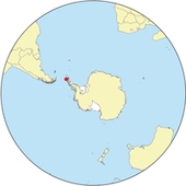 Location of Tabarin Peninsula
 Tabarin Peninsula Tabarin Peninsula (63°32'S 57°0'W/63.533°S 57°W/-63.533; -57) is a peninsula 15 nautical miles (28 km) long and 5 to 12 nautical miles (22 km) wide, lying south of the trough between Hope Bay and Duse Bay and forming the east extremity of Trinity Peninsula. Discovered and charted by the Swedish Antarctic Expedition, 1901-04, under Nordenskjöld. It was mapped in 1946 by the Falkland Islands Dependencies Survey (FIDS) and named after Operation Tabarin, the naval code name for the FIDS from 1943 to 1945.
All text is available under the terms of the GNU Free Documentation License (see Copyrights for details). About Wikipedia Disclaimers
Site Index Back to Top Photos Index Thanks for coming, I hope you
have enjoyed it, will recommend
it to your friends, and will come
back later to see my site developing
and expanding.
|

