|
|
|
|
|
|
|
|
|
|
|
|
Antarctica history and facts in briefUnofficial flag of Antarctica 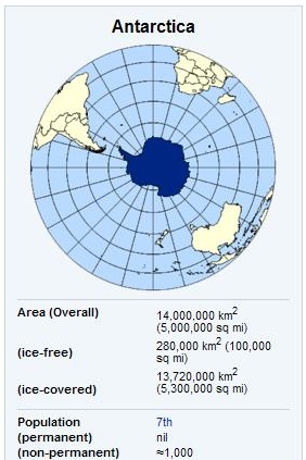
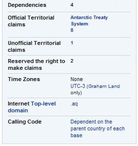
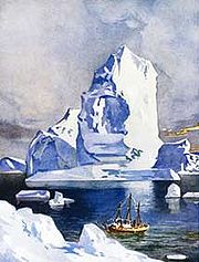
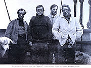
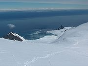
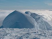
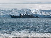
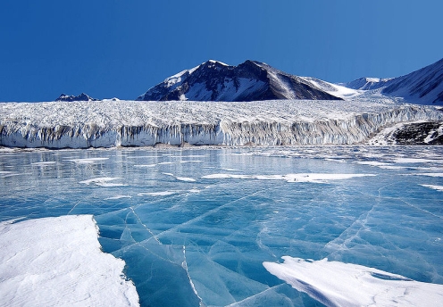
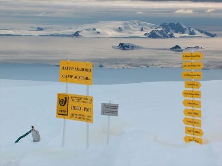
It is situated in the Antarctica region of the southern hemisphere, almost entirely south of the Antarctic Circle, and is surrounded by the Southern Ocean. At 14.0 million km² (5.4 million sq mi), it is the fifth-largest continent in area after Asia, Africa, North America, and South America. About 98% of Antarctica is covered by ice, which averages at least 1.6 kilometres (1.0 mi) in thickness. On average, Antarctica is the coldest, driest and windiest continent, and has the highest average elevation of all the continents. Antarctica is considered a desert, with annual precipitation of only 200 mm (8 inches) along the coast and far less inland. There are no permanent human residents, but anywhere from 1,000 to 5,000 people reside at the various research stations scattered across the continent throughout the year. Only cold-adapted plants and animals survive there, including penguins, seals, mosses, lichen, and many types of algae. The name Antarctica is the romanized version of the Greek compound word antarktiké, meaning "opposite to the north". Although myths and speculation about a Terra Australis ("Southern Land") date back to antiquity, the first confirmed sighting of the continent is commonly accepted to have occurred in 1820 by the Russian expedition of Mikhail Lazarev and Fabian Gottlieb von Bellingshausen. However, the continent remained largely neglected for the rest of the 19th century because of its hostile environment, lack of resources, and isolation. The first formal use of the name "Antarctica" as a continental name in the 1890s is attributed to the Scottish cartographer John George Bartholomew. The Antarctic Treaty was signed in 1959 by twelve countries; to date, forty-six countries have signed the treaty. The treaty prohibits military activities and mineral mining, supports scientific research, and protects the continent's ecozone. Ongoing experiments are conducted by more than 4,000 scientists of many nationalities and with different research interests. History Belief in the existence of a Terra Australis - a vast continent in the far south of the globe to "balance" the northern lands of Europe, Asia and North Africa - had existed since the times of Ptolemy (1st century AD), who suggested the idea to preserve the symmetry of all known landmasses in the world. Depictions of a large southern landmass were common in maps such as the early 16th century Turkish Piri Reis map. Even in the late 17th century, after explorers had found that South America and Australia were not part of the fabled "Antarctica", geographers believed that the continent was much larger than its actual size. European maps continued to show this hypothetical land until Captain James Cook's ships, HMS Resolution and Adventure, crossed the Antarctic Circle on 17 January 1773, in December 1773 and again in January 1774. Cook in fact came within about 75 miles (121 km) of the Antarctic coast before retreating in the face of field ice in January 1773. The first confirmed sighting of Antarctica can be narrowed down to the crews of ships captained by three individuals. According to various organizations (the National Science Foundation, NASA, the University of California, San Diego, and other sources), ships captained by three men sighted Antarctica in 1820: Fabian Gottlieb von Bellingshausen (a captain in the Russian Imperial Navy), Edward Bransfield (a captain in the Royal Navy), and Nathaniel Palmer (an American sealer out of Stonington, Connecticut). Von Bellingshausen saw Antarctica on 27 January 1820, three days before Bransfield sighted land, and ten months before Palmer did so in November 1820. On that day he two-ship expedition led by Von Bellingshausen and Mikhail Petrovich Lazarev reached a point within 32 kilometers (20 miles) of the Antarctic mainland and saw ice fields there. The first documented landing on mainland Antarctica was by the American sealer John Davis in Western Antarctica on 7 February 1821, although some historians dispute this claim. In December 1839, as part of the United States Exploring Expedition of 1838-42 conducted by the United States Navy (sometimes called the "Ex. Ex.", or "the Wilkes Expedition"), an expedition sailed from Sydney, Australia, into the Antarctic Ocean, as it was then known, and reported the discovery "of an Antarctic continent west of the Balleny Islands". That part of Antarctica was later named "Wilkes Land", a name it maintains to this day. In 1841, explorer James Clark Ross passed through what is now known as the Ross Sea and discovered Ross Island (both of which were named for him). He sailed along a huge wall of ice that was later named the Ross Ice Shelf (also named for him). Mount Erebus and Mount Terror are named after two ships from his expedition: HMS Erebus and Terror. Mercator Cooper landed in Eastern Antarctica on 26 January 1853. During the Nimrod Expedition led by Ernest Shackleton in 1907, parties led by T. W. Edgeworth David became the first to climb Mount Erebus and to reach the South Magnetic Pole. Douglas Mawson, who assumed the leadership of the Magnetic Pole party on their perilous return, went on to lead several expeditions until retiring in 1931. In addition, Shackleton himself and three other members of his expedition made several firsts in December 1908 - February 1909: they were the first humans to traverse the Ross Ice Shelf, the first to traverse the Transantarctic Mountain Range (via the Beardmore Glacier), and the first to set foot on the South Polar Plateau. On 14 December 1911, an expedition led by Norwegian polar explorer Roald Amundsen from the ship Fram became the first to reach the geographic South Pole, using a route from the Bay of Whales and up the Axel Heiberg Glacier. One month later, the ill-fated Scott Expedition reached the pole. Richard Evelyn Byrd led several voyages to the Antarctic by plane in the 1930s and 1940s. He is credited with implementing mechanized land transport on the continent and conducting extensive geological and biological research. However, it was not until 31 October 1956 that anyone set foot on the South Pole again; on that day a U.S. Navy group led by Rear Admiral George J. Dufek successfully landed an aircraft there. The first person to sail single-handed to Antarctica was the New Zealander David Henry Lewis, in a 10-meter steel sloop Ice Bird. 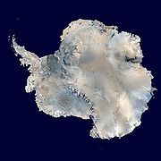 A satellite composite image
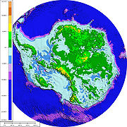
of Antarctica  Elevation colorized relief.
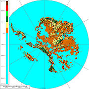
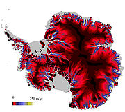 Speed of ice streams.
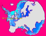 Size comparison
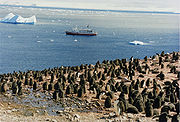
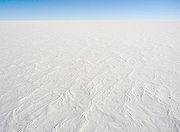
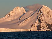
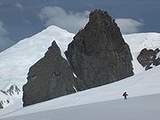
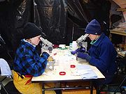
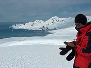
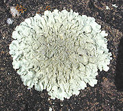
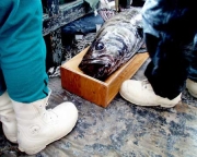
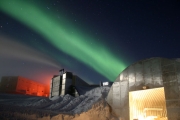
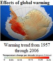
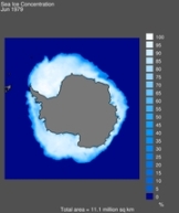
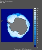
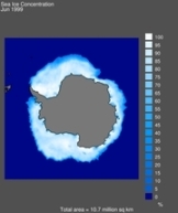
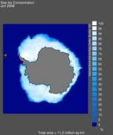
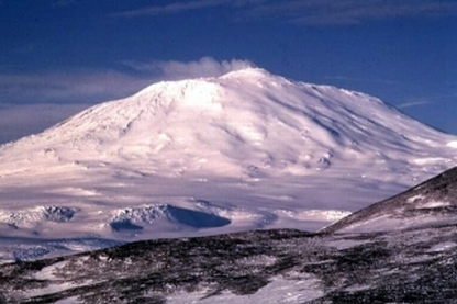
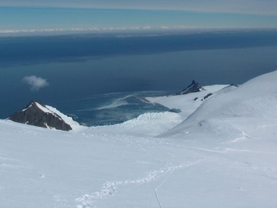
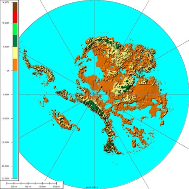
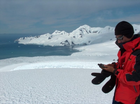
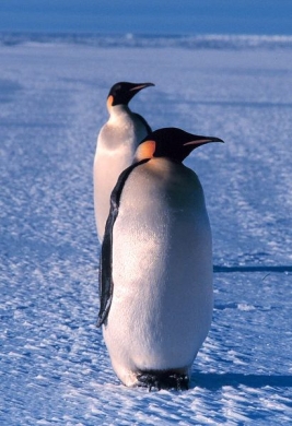
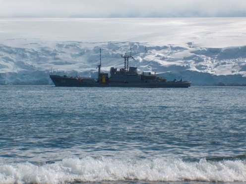
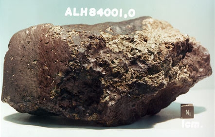
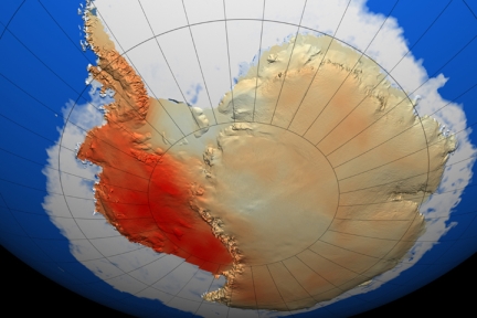
Europe-Antarctica Centered asymmetrically around the South Pole and largely south of the Antarctic Circle, Antarctica is the southernmost continent and is surrounded by the Southern Ocean; alternatively, it may be considered to be surrounded by the southern Pacific, Atlantic, and Indian Oceans, or by the southern waters of the World Ocean. It covers more than 14 million km² (5.4 million sq mi), making it the fifth-largest continent, about 1.3 times as large as Europe. The coastline measures 17,968 kilometres (11,160 mi) and is mostly characterized by ice formations, as the following table shows: 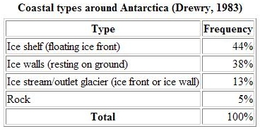 The portion west of the Weddell Sea and east of the Ross Sea is called Western Antarctica and the remainder Eastern Antarctica, because they roughly correspond to the Western and Eastern Hemispheres relative to the Greenwich meridian. About 98% of Antarctica is covered by the Antarctic ice sheet, a sheet of ice averaging at least 1.6 kilometres (1.0 mi) thick. The continent has about 90% of the world's ice (and thereby about 70% of the world's fresh water). If all of this ice were melted, sea levels would rise about 60 metres (200 ft). In most of the interior of the continent, precipitation is very low, down to 20 millimetres (0.8 in) per year; in a few "blue ice" areas precipitation is lower than mass loss by sublimation and so the local mass balance is negative. In the dry valleys the same effect occurs over a rock base, leading to a desiccated landscape. West Antarctica is covered by the West Antarctic Ice Sheet. The sheet has been of recent concern because of the real, if small, possibility of its collapse. If the sheet were to break down, ocean levels would rise by several metres in a relatively geologically short period of time, perhaps a matter of centuries. Several Antarctic ice streams, which account for about 10% of the ice sheet, flow to one of the many Antarctic ice shelves. East Antarctica lies on the Indian Ocean side of the Transantarctic Mountains and comprising Coats Land, Queen Maud Land, Enderby Land, Mac Robertson Land, Wilkes Land and Victoria Land. All but a small portion of this region lies within the Eastern Hemisphere. East Antarctica is largely covered by the East Antarctic Ice Sheet. Vinson Massif, the highest peak in Antarctica at 4,892 metres (16,050 ft), is located in the Ellsworth Mountains. Antarctica contains many other mountains, both on the main continent and the surrounding islands. Although Antarctica is home to many volcanoes, only Mount Erebus is known to be active. Located on Ross Island, Erebus is the southernmost active volcano. There is another famous volcano called Deception Island, which is famous for its giant eruption in 1970. Minor eruptions are frequent and lava flow has been observed in recent years. Other dormant volcanoes may potentially be active. In 2004, an underwater volcano was found in the Antarctic Peninsula by American and Canadian researchers. Recent evidence shows this unnamed volcano may be active. Antarctica is home to more than 70 lakes that lie at the base of the continental ice sheet. Lake Vostok, discovered beneath Russia's Vostok Station in 1996, is the largest of these subglacial lakes. It was once believed that the lake had been sealed off for 500,000 to one million years but a recent survey suggests that, every so often, there are large flows of water from one lake to another. There is some evidence, in the form of ice cores drilled to about 400 metres (1,300 ft) above the water line, that Vostok's waters may contain microbial life. The frozen surface of the lake shares similarities with Jupiter's moon Europa. If life is discovered in Lake Vostok, this would strengthen the argument for the possibility of life on Europa. On 7 February 2008, a NASA team embarked on a mission to Lake Untersee, searching for extremophiles in its highly-alkaline waters. If found, these resilient creatures could further bolster the argument for extraterrestrial life in extremely cold, methane-rich environments. Geology Geological history and paleontology More than 170 million years ago, Antarctica was part of the supercontinent Gondwana. Over time, Gondwana gradually broke apart and Antarctica as we know it today was formed around 25 million years ago. Paleozoic era (540-250 mya) During the Cambrian periodic stage, Gondwana had a mild climate. West Antarctica was partially in the Northern Hemisphere, and during this period large amounts of sandstones, limestones and shales were deposited. East Antarctica was at the equator, where sea floor invertebrates and trilobites flourished in the tropical seas. By the start of the Devonian period (416 mya), Gondwana was in more southern latitudes and the climate was cooler, though fossils of land plants are known from this time. Sand and silts were laid down in what is now the Ellsworth, Horlick and Pensacola Mountains. Glaciation began at the end of the Devonian period (360 mya), as Gondwana became centered around the South Pole and the climate cooled, though flora remained. During the Permian period, the plant life became dominated by fern-like plants such as Glossopteris, which grew in swamps. Over time these swamps became deposits of coal in the Transantarctic Mountains. Towards the end of the Permian period, continued warming led to a dry, hot climate over much of Gondwana. Mesozoic era (250-65 mya) As a result of continued warming, the polar ice caps melted and much of Gondwana became a desert. In East Antarctica, the seed fern became established, and large amounts of sandstone and shale were laid down at this time. The Antarctic Peninsula began to form during the Jurassic period (206-146 mya), and islands gradually rose out of the ocean. Ginkgo trees and cycads were plentiful during this period, as were reptiles such as Lystrosaurus. In West Antarctica, coniferous forests dominated through the entire Cretaceous period (146-65 mya), though Southern beech began to take over at the end of this period. Ammonites were common in the seas around Antarctica, and dinosaurs were also present, though only two Antarctic dinosaur genera (Cryolophosaurus, from the Hanson Formation, and Antarctopelta) have been described to date. It was during this period that Gondwana began to break up. Gondwanaland breakup (160-23 mya) The cooling of Antarctica occurred stepwise by the continental spread changing the oceanic currents from longitudinal equator-to-pole temperature-equalizing currents to latitudinal currents that preserved and accentuated latitude temperature differences. Africa separated from Antarctica around 160 mya, followed by the Indian subcontinent, in the early Cretaceous (about 125 mya). About 65 mya, Antarctica (then connected to Australia) still had a tropical to subtropical climate, complete with a marsupial fauna. About 40 mya Australia-New Guinea separated from Antarctica, so that latitudinal current could isolate Antarctica from Australia, and so the first ice began to appear. Around 23 mya, the Drake Passage opened between Antarctica and South America, which resulted in the Antarctic Circumpolar Current. The ice spread, replacing the forests that then covered the continent. Since about 15 mya, the continent has been mostly covered with ice, with the Antarctic ice cap reaching its present extension around 6 mya. Geology of present-day Antarctica The geological study of Antarctica has been greatly hindered by the fact that nearly all of the continent is permanently covered with a thick layer of ice. However, new techniques such as remote sensing, ground-penetrating radar and satellite imagery have begun to reveal the structures beneath the ice. Geologically, West Antarctica closely resembles the Andes mountain range of South America. The Antarctic Peninsula was formed by uplift and metamorphism of sea bed sediments during the late Paleozoic and the early Mesozoic eras. This sediment uplift was accompanied by igneous intrusions and volcanism. The most common rocks in West Antarctica are andesite and rhyolite volcanics formed during the Jurassic period. There is also evidence of volcanic activity, even after the ice sheet had formed, in Marie Byrd Land and Alexander Island. The only anomalous area of West Antarctica is the Ellsworth Mountains region, where the stratigraphy is more similar to the eastern part of the continent. East Antarctica is geologically very varied, dating from the Precambrian era, with some rocks formed more than 3 billion years ago. It is composed of a metamorphic and igneous platform which is the basis of the continental shield. On top of this base are various modern rocks, such as sandstones, limestones, coal and shales laid down during the Devonian and Jurassic periods to form the Transantarctic Mountains. In coastal areas such as Shackleton Range and Victoria Land some faulting has occurred. The main mineral resource known on the continent is coal. It was first recorded near the Beardmore Glacier by Frank Wild on the Nimrod Expedition, and now low-grade coal is known across many parts of the Transantarctic Mountains. The Prince Charles Mountains contain significant deposits of iron ore. The most valuable resources of Antarctica lie offshore, namely the oil and natural gas fields found in the Ross Sea in 1973. Exploitation of all mineral resources is banned until the year 2048 by the Protocol on Environmental Protection to the Antarctic Treaty. Climate Antarctica is the coldest place on Earth. The coldest natural temperature ever recorded on Earth was -89.2 °C (-128.6 °F) at the Russian Vostok Station in Antarctica on 21 July 1983. For comparison, this is 11 °C colder than subliming dry ice. Antarctica is a frozen desert with little precipitation; the South Pole itself receives less than 10 centimetres (4 in) per year, on average. Temperatures reach a minimum of between -80 °C and -90 °C (-112 °F and -130 °F) in the interior in winter and reach a maximum of between 5 °C and 15 °C (41 °F and 59 °F) near the coast in summer. Sunburn is often a health issue as the snow surface reflects almost all of the ultraviolet light falling on it. Eastern Antarctica is colder than its western counterpart because of its higher elevation. Weather fronts rarely penetrate far into the continent, leaving the centre cold and dry. Despite the lack of precipitation over the central portion of the continent, ice there lasts for extended time periods. Heavy snowfalls are not uncommon on the coastal portion of the continent, where snowfalls of up to 1.22 meters (48 in) in 48 hours have been recorded. At the edge of the continent, strong katabatic winds off the polar plateau often blow at storm force. In the interior, however, wind speeds are typically moderate. During summer, more solar radiation reaches the surface during clear days at the South Pole than at the equator because of the 24 hours of sunlight each day at the Pole. There is some evidence that Antarctica is warming as a result of human CO2 emissions. Antarctica is colder than the Arctic for two reasons. First, much of the continent is more than 3 kilometers (2 mi) above sea level, and temperature decreases with elevation. Second, the Arctic Ocean covers the north polar zone: the ocean's relative warmth is transferred through the icepack and prevents temperatures in the Arctic regions from reaching the extremes typical of the land surface of Antarctica. Given the latitude, long periods of constant darkness or constant sunlight create climates unfamiliar to human beings in much of the rest of the world. The aurora australis, commonly known as the southern lights, is a glow observed in the night sky near the South Pole created by the plasma-full solar winds that pass by the Earth. Another unique spectacle is diamond dust, a ground-level cloud composed of tiny ice crystals. It generally forms under otherwise clear or nearly clear skies, so people sometimes also refer to it as clear-sky precipitation. A sun dog, a frequent atmospheric optical phenomenon, is a bright "spot" beside the true sun. Population Antarctica has no permanent residents, but a number of governments maintain permanent manned research stations throughout the continent. The number of people conducting and supporting scientific research and other work on the continent and its nearby islands varies from about 1,000 in winter to about 5,000 in the summer. Many of the stations are staffed year-round, the over-wintering personnel typically arriving from their home countries for a one-year assignment. An Orthodox church opened in 2004 at the Russian Bellingshausen Station is also manned year-round by one or two priests, which are similarly rotated every year. The first semi-permanent inhabitants of regions near Antarctica (areas situated south of the Antarctic Convergence) were British and American sealers who used to spend a year or more on South Georgia, from 1786 onward. During the whaling era, which lasted until 1966, the population of that island varied from over 1,000 in the summer (over 2,000 in some years) to some 200 in the winter. Most of the whalers were Norwegian, with an increasing proportion of Britons. The settlements included Grytviken, Leith Harbour, King Edward Point, Stromness, Husvik, Prince Olav Harbour, Ocean Harbour and Godthul. Managers and other senior officers of the whaling stations often lived together with their families. Among them was the founder of Grytviken, Captain Carl Anton Larsen, a prominent Norwegian whaler and explorer who, along with his family, adopted British citizenship in 1910. The first child born in the southern polar region was Norwegian girl Solveig Gunbjørg Jacobsen, born in Grytviken on 8 October 1913, and her birth was registered by the resident British Magistrate of South Georgia. She was a daughter of Fridthjof Jacobsen, the assistant manager of the whaling station, and of Klara Olette Jacobsen. Jacobsen arrived on the island in 1904 to become the manager of Grytviken, serving from 1914 to 1921; two of his children were born on the island. Emilio Marcos Palma was the first person born on the Antarctic mainland, at Base Esperanza in 1978; his parents were sent there along with seven other families by the Argentine government to determine if family life was suitable on the continent. In 1984, Juan Pablo Camacho was born at the Frei Montalva Station, becoming the first Chilean born in Antarctica. Several bases are now home to families with children attending schools at the station. Flora and fauna Flora The climate of Antarctica does not allow extensive vegetation. A combination of freezing temperatures, poor soil quality, lack of moisture, and lack of sunlight inhibit the flourishing of plants. As a result, plant life is limited to mostly mosses and liverworts. The autotrophic community is made up of mostly protists. The flora of the continent largely consists of lichens, bryophytes, algae, and fungi. Growth generally occurs in the summer, and only for a few weeks at most. There are more than 200 species of lichens and about 50 species of bryophytes, such as mosses. Seven hundred species of algae exist, most of which are phytoplankton. Multicolored snow algae and diatoms are especially abundant in the coastal regions during the summer. There are two species of flowering plants found in the Antarctic Peninsula: Deschampsia antarctica (Antarctic hair grass) and Colobanthus quitensis (Antarctic pearlwort). Fauna Few terrestrial vertebrates live in Antarctica. Invertebrate life includes microscopic mites, lice, nematodes, tardigrades, rotifers, krill and springtails. The flightless midge Belgica antarctica, just 12 millimetres (0.5 in) in size, is the largest purely terrestrial animal in Antarctica. The Snow Petrel is one of only three birds that breed exclusively in Antarctica. They have been seen at the South Pole. A variety of marine animals exist and rely, directly or indirectly, on the phytoplankton. Antarctic sea life includes penguins, blue whales, orcas, colossal squids and fur seals. The Emperor penguin is the only penguin that breeds during the winter in Antarctica, while the Adélie Penguin breeds farther south than any other penguin. The Rockhopper penguin has distinctive feathers around the eyes, giving the appearance of elaborate eyelashes. King penguins, Chinstrap penguins, and Gentoo Penguins also breed in the Antarctic. The Antarctic fur seal was very heavily hunted in the 18th and 19th centuries for its pelt by sealers from the United States and the United Kingdom. The Weddell Seal, a "true seal", is named after Sir James Weddell, commander of British sealing expeditions in the Weddell Sea. Antarctic krill, which congregates in large schools, is the keystone species of the ecosystem of the Southern Ocean, and is an important food organism for whales, seals, leopard seals, fur seals, squid, icefish, penguins, albatrosses and many other birds. The passing of the Antarctic Conservation Act in the U.S. brought several restrictions to U.S. activity on the continent. The introduction of alien plants or animals can bring a criminal penalty, as can the extraction of any indigenous species. The overfishing of krill, which plays a large role in the Antarctic ecosystem, led officials to enact regulations on fishing. The Convention for the Conservation of Antarctic Marine Living Resources (CCAMLR), a treaty that came into force in 1980, requires that regulations managing all Southern Ocean fisheries consider potential effects on the entire Antarctic ecosystem. Despite these new acts, unregulated and illegal fishing, particularly of Patagonian toothfish (marketed as Chilean Sea Bass in the U.S.), remains a serious problem. The illegal fishing of toothfish has been increasing, with estimates of 32,000 tonnes (35,300 short tons) in 2000. A census of sea life carried out during the International Polar Year and which involved some 500 researchers is due for release in 2010. The research is part of the global Census of Marine Life (CoML) and has disclosed some remarkable findings. More than 235 marine organisms live in both polar regions, having bridged the gap of 12 000 km. Large animals such as some cetaceans and birds make the round trip annually. More surprising are small forms of life such as mudworms, sea cucumbers and free-swimming snails found in both polar oceans. Various factors may aid in their distribution - fairly uniform temperatures of the deep ocean at the poles and the equator which differ by no more than 50C, and the major current systems or marine conveyor belt which transport egg and larvae stages. Politics Antarctica has no government and belongs to no country. Various countries claim areas of it, but while some have mutually recognized each other's claims, no other countries recognize such claims. Since 1959, new claims on Antarctica have been suspended and the continent is considered politically neutral. Its status is regulated by the 1959 Antarctic Treaty and other related agreements, collectively called the Antarctic Treaty System. For the purposes of the Treaty System, Antarctica is defined as all land and ice shelves south of 60° S. The treaty was signed by twelve countries, including the Soviet Union (and later Russia), the United Kingdom, Argentina, Chile, Australia and the United States. It set aside Antarctica as a scientific preserve, established freedom of scientific investigation, environmental protection, and banned military activity on that continent. This was the first arms control agreement established during the Cold War. In 1983, the Antarctic Treaty Parties began negotiations on a convention to regulate mining in Antarctica. A coalition of international organisations launched a public pressure campaign to prevent any minerals development in the region, led largely by Greenpeace International[44] which established its own scientific station - World Park Base - in the Ross Sea region and conducted annual expeditions to document environmental impacts from human activities on the continent. In 1988, the Convention on the Regulation of Antarctic Mineral Resources (CRAMRA) was adopted. The following year, however, Australia and France announced that they would not ratify the convention, rendering it dead for all intents and purposes. Instead, they proposed that a comprehensive regime to protect the Antarctic environment be negotiated in its place. As other countries followed suit, the Protocol on Environmental Protection to the Antarctic Treaty (the 'Madrid Protocol') was negotiated and on 14 January 1998 it entered into force. The Madrid Protocol bans all mining activities in Antarctica, designating the continent as a 'natural reserve devoted to peace and science'. The Antarctic Treaty prohibits any military activity in Antarctica, such as the establishment of military bases and fortifications, the carrying out of military manoeuvers, or the testing of any type of weapon. Military personnel or equipment are permitted only for scientific research or for other peaceful purposes. The only documented land military manoeuvre was Operation NINETY, undertaken by the Argentine military. The United States military issues the Antarctica Service Medal to military members or civilians who perform research duty in Antarctica. The medal includes a "wintered over" bar issued to those who remain on the continent for two complete six-month seasons. 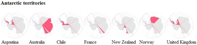 Antarctic territorial claims 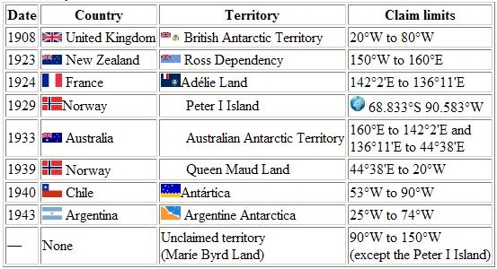 The Argentine, British and Chilean claims all overlap, and have caused friction. Australia claims the largest area. Countries interested in participating in a possible territorial division of Antarctica. This group of countries participating as members of Antarctica Treaty have a territorial interest in the Antarctic continent but the provisions of the Treaty do not allow them to make their claims while it is in force.  Nazi Germany also maintained a claim to Antarctica, known as New Swabia, between 1939 and 1945. It was situated from 20°E to 10°W, overlapping Norway's claim. The claim was abandoned after the fall of Nazi Germany in 1945. Economy Although coal, hydrocarbons, iron ore, platinum, copper, chromium, nickel, gold and other minerals have been found, they have not been in large enough quantities to exploit. The 1991 Protocol on Environmental Protection to the Antarctic Treaty also restricts a struggle for resources. In 1998, a compromise agreement was reached to place an indefinite ban on mining, to be reviewed in 2048, further limiting economic development and exploitation. The primary economic activity is the capture and offshore trading of fish. Antarctic fisheries in 2000-01 reported landing 112,934 tonnes. Small-scale "expedition tourism" has existed since 1957 and is currently subject to Antarctic Treaty and Environmental Protocol provisions, but in effect self-regulated by the International Association of Antarctica Tour Operators (IAATO). .Not all vessels associated with Antarctic tourism are members of IAATO, but IAATO members account for 95% of the tourist activity. Travel is largely by small or medium ship, focusing on specific scenic locations with accessible concentrations of iconic wildlife. A total of 37,506 tourists visited during the 2006-07 Austral summer with nearly all of them coming from commercial ships. The number is predicted to increase to over 80,000 by 2010. There has been some recent concern over the potential adverse environmental and ecosystem effects caused by the influx of visitors. A call for stricter regulations for ships and a tourism quota have been made by some environmentalists and scientists. The primary response by Antarctic Treaty Parties has been to develop, through their Committee for Environmental Protection and in partnership with IAATO, "site use guidelines" setting landing limits and closed or restricted zones on the more frequently visited sites. Antarctic sight seeing flights (which did not land) operated out of Australia and New Zealand until the fatal crash of Air New Zealand Flight 901 in 1979 on Mount Erebus, which killed all 257 aboard. Qantas resumed commercial overflights to Antarctica from Australia in the mid-1990s. Transport Transport on the continent has transformed from explorers crossing the isolated remote area of Antarctica on foot to a more open area due to human technologies enabling more convenient and faster transport by land and predominantly by air and water. The use of dogs to pull researchers and sledges has been banned on objections that dogs are an alien species to Antarctica. Electric buggies used in place of the dogs are disadvantaged in that while dogs could sense crevices and thin ice, the buggies can not. Research Each year, scientists from 27 different nations conduct experiments not reproducible in any other place in the world. In the summer more than 4,000 scientists operate research stations; this number decreases to nearly 1,000 in the winter. McMurdo Station is capable of housing more than 1,000 scientists, visitors, and tourists. Researchers include biologists, geologists, oceanographers, physicists, astronomers, glaciologists, and meteorologists. Geologists tend to study plate tectonics, meteorites from outer space, and resources from the breakup of the supercontinent Gondwanaland. Glaciologists in Antarctica are concerned with the study of the history and dynamics of floating ice, seasonal snow, glaciers, and ice sheets. Biologists, in addition to examining the wildlife, are interested in how harsh temperatures and the presence of people affect adaptation and survival strategies in a wide variety of organisms. Medical physicians have made discoveries concerning the spreading of viruses and the body's response to extreme seasonal temperatures. Astrophysicists at Amundsen-Scott South Pole Station study the celestial dome and cosmic microwave background radiation. Many astronomical observations are better made from the interior of Antarctica than from most surface locations because of the high elevation, which results in a thin atmosphere, low temperature, which minimizes the amount of water vapour in the atmosphere, and absence of light pollution, thus allowing for a view of space clearer than anywhere else on Earth. Antarctic ice serves as both the shield and the detection medium for the largest neutrino telescope in the world, built 2 kilometers below Amundsen-Scott station. Since the 1970s, an important focus of study has been the ozone layer in the atmosphere above Antarctica. In 1985, three British Scientists working on data they had gathered at Halley Station on the Brunt Ice Shelf discovered the existence of a hole in this layer. In 1998, NASA satellite data showed that the Antarctic ozone hole was the largest on record, covering 27 million km² (10 million sq mi). It was eventually determined that the destruction of the ozone was caused by chlorofluorocarbons emitted by human products. With the ban of CFCs in the Montreal Protocol of 1989, it is believed that the ozone hole will close up over the next fifty years. Princess Elisabeth Polar Science Station On 6 September 2007, Belgian-based International Polar Foundation unveiled the Princess Elisabeth station, the world's first zero-emissions polar science station in Antarctica to research climate change. Costing $16.3 million, the prefabricated station, which is part of International Polar Year, was shipped to the South Pole from Belgium by the end of 2008 to monitor the health of the polar regions. Belgian polar explorer Alain Hubert stated: "This base will be the first of its kind to produce zero emissions, making it a unique model of how energy should be used in the Antarctic." Johan Berte is the leader of the station design team and manager of the project which conducts research in climatology, glaciology and microbiology. Meteorites Meteorites from Antarctica are an important area of study of material formed early in the solar system; most are thought to come from asteroids, but some may have originated on larger planets. The first meteorites were found in 1912. In 1969, a Japanese expedition discovered nine meteorites. Most of these meteorites have fallen onto the ice sheet in the last million years. Motion of the ice sheet tends to concentrate the meteorites at blocking locations such as mountain ranges, with wind erosion bringing them to the surface after centuries beneath accumulated snowfall. Compared with meteorites collected in more temperate regions on Earth, the Antarctic meteorites are well-preserved. This large collection of meteorites allows a better understanding of the abundance of meteorite types in the solar system and how meteorites relate to asteroids and comets. New types of meteorites and rare meteorites have been found. Among these are pieces blasted off the Moon, and probably Mars, by impacts. These specimens, particularly ALH84001 discovered by ANSMET, are at the centre of the controversy about possible evidence of microbial life on Mars. Because meteorites in space absorb and record cosmic radiation, the time elapsed since the meteorite hit the Earth can be determined from laboratory studies. The elapsed time since fall, or terrestrial residence age, of a meteorite represents more information that might be useful in environmental studies of Antarctic ice sheets. In 2006, a team of researchers from Ohio State University used gravity measurements by NASA's GRACE satellites to discover the 300-mile (480 km)-wide Wilkes Land crater, which probably formed about 250 million years ago. Volcanic eruption In January 2008, the British Antarctic Survey (Bas) scientists, led by Hugh Corr and David Vaughan, reported (in the journal Nature Geoscience) that 2,200 years ago, a volcano erupted under Antarctica ice sheet (based on airborne survey with radar images). The biggest eruption in Antarctica in the last 10,000 years, the volcanic ash was found deposited on the ice surface under the Hudson Mountains, close to Pine Island Glacier. Effects of global warming Most of the continent's icy mass has so far proven largely impervious to climate change, being situated on solid rock; its deep interior is actually growing in volume as a result of increased precipitation. The Antarctic contribution to sea-level rise has long been uncertain. A recent report by CPOM suggests that Antarctica has provided, at most, a negligible component of observed sea-level rise - indeed a survey of 72% of the Antarctic ice suggests an attributable short-term lowering of global sea levels by 0.08 mm per year. Conversely, a 10 year comparison of the balance between glacier decline and snowfall accumulation found that ice loss had increased 75%. In 2006, Antarctica lost a net 200 billion tonnes of ice. However, Antarctica's periphery has been warming up, particularly on the Antarctic Peninsula and in Pine Island Bay, which together are contributing to a rise in sea levels. In 2003 the Larsen-B ice shelf collapsed.[68] Between 28 February and 8 March 2008, about 570 square kilometers of ice from the Wilkins Ice Shelf in Western Antarctica collapsed, putting the remaining 15,000 square kilometers of the ice shelf at risk. The ice is being held back by a "thread" of ice about 6 km wide. According to NASA, the most significant Antarctic melting in the past 30 years occurred in 2005, when a mass of ice comparable in size to California briefly melted and refroze; this may have resulted from temperatures rising to as high as 5 °C (41 °F). In contrast to the break up of some ice shelves (ice that formed on land and has now moved so it is floating on the sea) along the peninsula, the amount of sea ice (ice formed by freezing ocean water) around Antarctica has remained stable, or even increased some, over the past 30 years. The average extent of Antarctic sea ice in one month can differ by as much as 1 million square kilometers from the long-term average for that month. The area covered by Antarctic sea ice has shown a small increasing trend (0.8% per decade). The sea ice concentration of Antarctica in June 2008 is virtually the same as that in June 1979. Images showing the Sea Ice Index around Antarctica in four different years in June.
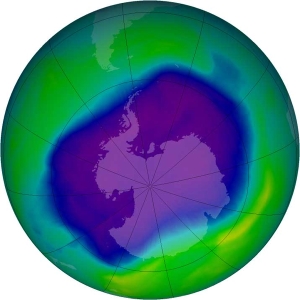
Antarctic ozone depletion There is a large ozone hole over Antarctica which was detected by scientists in 1973 and continues to grow to this day. The ozone hole is attributed to the emission of chlorofluorocarbons or CFCs into the atmosphere, which decompose the ozone into other gases.
All text is available under the terms of the GNU Free Documentation License (see Copyrights for details). About Wikipedia Disclaimers
Site Index Back to Top Photos Index Thanks for coming, I hope you
have enjoyed it, will recommend
it to your friends, and will come
back later to see my site developing
and expanding.
|


