South Island
New Zealand facts & history in brief
 New Zealand Map
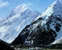
Aoraki-Mount Cook
is in the Mount Cook National
Park, at 3753 metres is New Zealand's
highest mountain.
In 1991 10.5 metres fell off the
top because the failure of the underlying
bedrock, causing an avalanche of
rock, snow and ice.
The Hooker Glacier runs on the west
side and the Tasman Glacier on the
east side of the ridge.
Mount Cook was first conquered on
Christmas Day, 1894, by George Graham,
Thomas Fyfe and Jack Clarke, from
the Hooker Glacier.
There are a number of climbing routes
but the most popular is up the north-east
face, a route from the south gives
climbers a chance to traverse the
three peaks.
It was named after James Cook, by
Captain J.L. Stokes, of the survey
ship, Acheron.
The Maori name is Aorangi or Aoraki,
which used now days.
The 69 958 ha Mount Cook National
Park, established in 1953, has 19
peaks higher than 3000 metres and
five major glaciers Tasman (The
largest glaciers in the world outside
the polar regions, 29 kilometres
long and up to nine kilometres wide.
The Mount Cook lily, grows in abundance
in the park with the snow gentian
and the flowering mountain ribbonwood.
The world famous Mount Cook Hotel
is 747 metres up on the slopes of
the Hooker Valley.

You can click on these photos for
an enlargement.
 |
 |
 |
 |
|
Aoraki-Mt Cook |
Aoraki-Mt Cook |
Aoraki-Mt Cook |
Aoraki-Mt Cook |
 |
 |
 |
 |
|
Aoraki-Mt Cook |
Aoraki-Mt Cook |
Aoraki-Mt Cook |
Aoraki-Mt Cook |

Site
Index
Back to Top
Photos Index
Thanks for coming, I hope you
have enjoyed it, will recommend
it to your friends, and will come
back later to see my site developing
and expanding.
I'm trying to make my pages
enjoyable and trouble free for everyone,
please let me know of any mistakes
or trouble with links, so I can
fix any problem as soon as possible.
These pages are best viewed with
monitor resolution set at
800x600 and kept simple on purpose
so everyone can enjoy them
across all media and platforms.
Thank you.
Webmaster

|