|
|
|
|
|
|
|
|
|
|
|
|
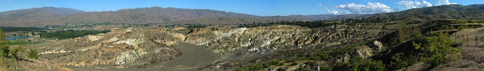
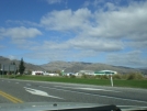
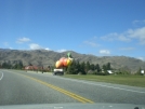
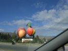
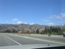
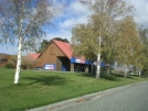
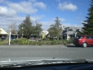
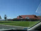
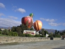
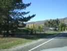
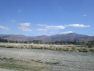
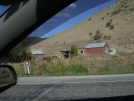
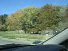
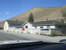
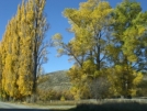
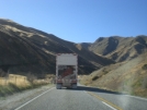
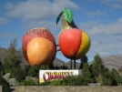
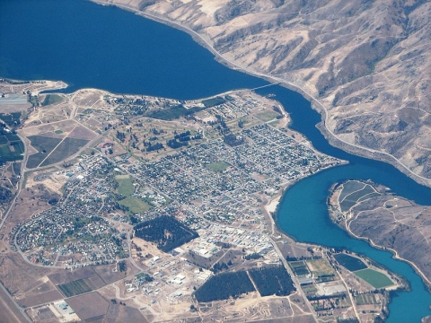
Cromwell 2009South Island - New ZealandNew Zealand facts & history in brief New Zealand Map 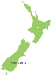 Location of Cromwell Cromwell Cromwell is a town in Central Otago in the Otago region of New Zealand. It is situated between State Highway 6 (linking to Wanaka, 50 km north, and Queenstown, 60 km west) and State Highway 8 leading to the Lindis Pass, 75 km northeast, and Alexandra, 33 km south. The road to Alexandra winds through the Cromwell Gorge. Nearby settlements are at Bannockburn, Lowburn, Tarras, and Ripponvale. Cromwell is also the home of the Cromwell Chafer Beetle (Prodontria lewisi). Population Central Otago: 16,650 Cromwell: 4,080 History Cromwell was originally known as "The Junction", being at the confluence of the Clutha and Kawarau Rivers. In 1862, gold was discovered below the Junction by two miners, Hartley and Reilly. Once the word of a gold strike was out, there was an influx of several thousand miners to the area. As gold ran out, Cromwell became the service centre for an extensive farming and stone fruit growing area. It has a strategic location between the Lindis and the Haast Pass, and acts as a hub between the towns of Wanaka, Queenstown and Alexandra. The former is commemorated with the giant sculpture of stone fruit which stands outside the northern end of the town. Cromwell lay at the confluence of the Clutha River and Kawarau River, which was noted for the difference between the colours of the waters of the two rivers and also for the historic bridge at the convergence of the two. Since the construction of the Clyde Dam and the filling of Lake Dunstan in the early 1990s the river confluence was drowned, as was the old town centre. The decision to build Clyde Dam and use Cromwell as the accommodation base brought many changes to the town. Approximately one-third of the town was rebuilt on higher ground. The changes included the doubling of the residential area, relocation of the old town centre (now called "Old Cromwell Town"), upgrading of services, and the provision of modern educational and sports facilities, and a new bridge. The relocated town centre, or "The Mall," now houses the main retail, service and civic buildings in Cromwell. Several of the old buildings of the town which escaped the flooding have been retained as a historic precinct close to the shore of the Kawarau. The town was named after Oliver Cromwell and, as well as "The Junction", the town was previously known as "The Point" and "Kawarau". The future of Cromwell is in farming, horticulture, viticulture, and tourism. Cromwell is nicknamed the "Fruit Bowl of the South". Panorama of the historic Bannockburn gold diggings near Cromwell. Education Cromwell has three pre-school facilities, two primary schools and a co- educational secondary school. An Otago Polytechnic campus specialises in horticulture, catering and tourism. Its crop centre provides advisory services to horticulturalists on commercially-viable new crops. Central Otago Climate Central Otago is a land of extremes: it is the coldest, driest part of New Zealand. The seasons are sharply defined: summers are hot and low in humidity; winter mornings are often misty, the days cloudless and windless and the nights freezing. Alexandra, for example, has the lowest average annual rainfall (340mm) recorded anywhere in New Zealand, is the least windy and has 148 frosts annually (only Lake Tekapo, with 149, has more). Ophir, 27km away, holds the record for the lowest air temperature recorded - minus 21.6 deg C in mid-1995 - but it also held the highest reading (35.2 deg C in 1959) until 42.4 deg C was recorded at Rangiora, in Canterbury in 1973. Spring warms the soil and fruit tree blossom dominates the districts orchard areas. Temperatures range from minus 3 to 20 deg C, with 10 frosts a month. Average rainfall is 28mm a month and sunshine 206 hours. In summer, daylight lasts as long as 10pm. Temperatures range from 10 to plus 30 deg C on several days. Rainfall averages 38mm a month and sunshine is 227 hours. Autumn is brilliant as the extensive orchards and poplar shelterbelts turn red, yellow and gold. Temperatures range from minus 3 to 24 deg C. Rainfall averages 30mm a month with 11 frosts monthly and 150 hours of sunshine. Winter brings a temperature range of minus 6 to 15 deg C, and average monthly rainfall of 15mm, 25 days frosts and 107 hours of sunshine per month during the short days. Historical Places of Interest Bannockburn Bridge The sign on the south side was reconstructed from the original suspension bridge's pillars. Bannockburn An historic town which was once the centre of a thriving and successful gold mining industry. Remnants include the hotel, Post Office, Stewart's store, and many old dwellings. Now a restful area centred around viticulture and agriculture. Bannockburn Hotel A cute old pub, an oasis in the desert. The Bannockburn Sluicings Walk through an incredible landscape changed by hand in the pursuit of gold. The round trip is full of history and interest. Bendigo Goldfields Bendigo was a successful quartz mining area for over half a century. From the site of the old Bendigo township at the top of the Bendigo Loop Road a steep, narrow vehicle track winds up into the hills to Logantown and even further up to Welshtown, where some of the most striking remains of old stone cottages can be found. Carrick Goldfields The ruins of Carricktown are 4km up a 4WD track from the old mining area of Quartzville (near the end of Quartzville Road), and the Young Australian 6m overshot water-wheel can be found a further 3km on. The track continues up to Duffer's Saddle. Return down Nevis Road to Bannockburn. Cromwell Gorge Hartley and Reilly first discovered gold at the beginning of this rugged and spectacular gorge. Goldfields Mining Centre Step back in time and explore historic gold workings on a fascinating, self-guided tour. Discover the Chinese village and an operating stamper battery and sluice gun. Pan for gold! Take a thrilling jetboat ride through history. Old Cromwell Town The construction of the Clyde Dam and subsequent filling of Lake Dunstan in the 1980's brought major changes to Cromwell. Gone were two wild rivers... but there is now a beautiful new lake with many shoreline amenities. Acres of orchards were lost... but Cromwell has since become the fruit and wine centre of the south. Cromwell's original commercial area was drowned... but there is now a pleasant new town centre with modern facilities. However, the old town centre with its historic bridge has not been forgotten! Old Cromwell Incorporated was formed to do something positive about this loss, and the result is a splendid reminder of days gone by! While there is a lot of work yet to be done, many of the original town buildings have already been either restored or reconstructed. History lives on! And authenticity is the key word. Nowadays, Old Cromwell Town is home to local craftspeople and a café. And the bridge? It's still there, under 11m of water!
About Wikipedia Disclaimers
2009
Site Index Back to Top Photos Index Thanks for coming, I hope you
have enjoyed it, will recommend
it to your friends, and will come
back later to see my site developing
and expanding.
|


