New Zealand
New Zealand facts & history in brief
 New Zealand Map
Chatham Islands
The three main islands with
the total population less than a
thousand, are the Chatham, the largest
about 89.000 ha, (Quarter of the
island is covered by shallow lagoons),
Pitt, 6190 ha and the South-east
Island 260 ha.
There are a number of smaller islands
around them, and are about
850 km east of Christchurch.
In 1791 Lieutenant William Broughton
was the first European to discover the
islands and named it after his ship.
The islands are very exposed,
windswept, cold and wet.
The main activities and industries are
sheep farming, fishing, crayfishing and processing.
The largest settlement is Waitangi.
The original settlers were the Morioris.
Due to the lack of trees in the islands the
Morioris were among the world's
most isolated people.
In 1835 the islands were invaded
by a Maori force from the mainland
and were almost extinguished.

You can click on these photos for an enlargement.
 |
 |
 |
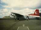
Chatham
'International'
Airport |
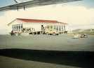
Chatham
'International'
Airport |
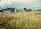
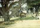
Chatham Islands |
 |
 |
 |
|
Chatham Islands |
Chatham Islands |
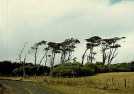
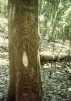
'Tree carvings' |
Site
Index
Back to Top
Photos Index
Thanks for coming, I hope you
have enjoyed it, will recommend
it to your friends, and will come
back later to see my site developing
and expanding.
I'm trying to make my pages
enjoyable and trouble free for everyone,
please let me know of any mistakes
or trouble with links, so I can
fix any problem as soon as possible.
These pages are best viewed with
monitor resolution set at
800x600 and kept simple on purpose
so everyone can enjoy them
across all media and platforms.
Thank you.
Webmaster

|