|
|
|
|
|
|
|
|
|
|
|
|
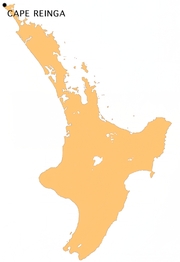
Cape ReingaNorth Island - New Zealand
New Zealand facts & history in brief
Cape Reinga
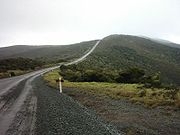
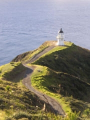
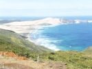
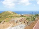
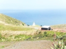
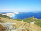
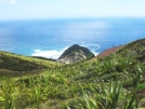
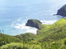
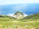
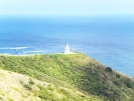
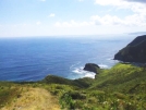
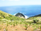
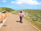
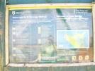
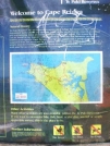
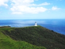
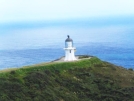
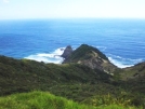
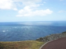
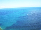
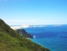
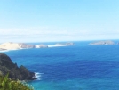
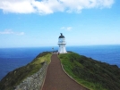
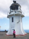
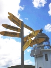
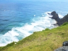
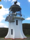
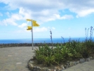
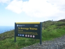
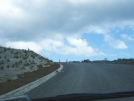
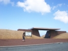
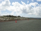
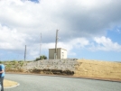
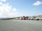
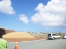
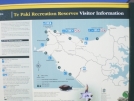
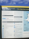
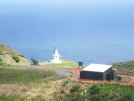
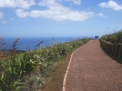
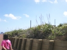
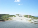
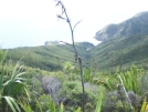
Cape Reinga is located over 100 km north of the nearest small town of Kaitaia. There is a road all the way but the final 19 km are 'metal' road (which is to be upgraded to a standard seal within the next years). Suitable vehicles can travel much of the way via Ninety Mile Beach and Te Paki stream bed. The name of the cape comes from the Māori word 'Reinga', meaning the 'Underworld'. Another Māori name is 'Te Rerenga Wairua', meaning the leaping-off place of spirits. Both refer to the Maori belief that the cape is the point where the spirits of the dead enter the underworld. As of January 2007, Cape Reinga is on the tentative list of UNESCO waiting to receive World Heritage Site status. The cape is already a favourite tourist attraction, with over 120,000 visitors a year and around 1,300 cars arriving per day during peak season. Visitor numbers are growing by about 5% a year, and the increase is likely to become even more pronounced once the road to the cape is fully sealed. Meeting of the seas Cape Reinga is generally considered the separation marker between the Tasman Sea to the west and the Pacific Ocean to the east. From the lighthouse it is possible to watch the tidal race, as the two seas clash to create unsettled waters just off the coast. The Māori refer to this as the meeting of Te Moana-a-Rehua, 'the sea of Rehua' with Te Tai-o-Whitirea, 'the sea of Whitirea', Rehua and Whitirea being a male and a female respectively. The cape is often mistakenly thought of as being the northernmost point of the North Island, and thus, of mainland New Zealand. However, North Cape's Surville Cliffs, 30 km east of Cape Reinga, are slightly further north. Another headland just to the west of Cape Reinga is Cape Maria van Diemen, which was discovered and named by the Dutch explorer Abel Tasman during his journey in 1642 and thought of by him to be the northernmost point of the newly-discovered country he named 'Staten Landt'. Maori mythology According to mythology, the spirits of the dead travel to Cape Reinga on their journey to the afterlife in the spiritual homeland of Hawaiki, using the Te Ara Wairua, the 'Spirits' pathway'. At Cape Reinga they depart the mainland by leaping off an 800 year old Pōhutukawa tree on the cape. They turn briefly at the Three Kings Islands for one last look back towards the land, then continue on their journey. A spring in the hillside, Te Waiora-a-Tāne (the 'Living waters of Tāne'), also played an important role in Māori ceremonial burials, representing a spiritual cleansing of the spirits, with water of the same name used in burial rites all over New Zealand. This significance lasted until the local population mostly converted to Christianity, and the spring was capped with a reservoir, with little protest from the mostly converted population of the area. However, the spring soon disappeared and only reappeared at the bottom of the cliff, making the reservoir useless. Restoration Recently (2007), protests by Māori as well as increases in tourist numbers have led the Department of Conservation to announce that the current public carpark and toilet facilities, which are intruding on traditionally sacred ground, would be moved further away from the cape and extended, at a cost of NZ$ 6.5 million. Work has also started on sealing the road to the Cape, on of the last stretches of State Highway 1 which is still a gravel road, and unsuited to the increasing tourism demands. The work will take about three years and include extensive roadside revegatation with over 150,000 plants to prevent erosion. Cape Reinga Lighthouse The lighthouse at Cape Reinga was built in 1941 and first lit during May of that year, replacing a lighthouse located on nearby Motuopao Island, which had been built 1879. In 1987, the lighthouse was fully automated and the lighthouse keepers were withdrawn. The previous 1000 watt light has since been replaced with a 50 watt flashing beacon.
All text is available under the terms of the GNU Free Documentation License (see Copyrights for details). About Wikipedia Disclaimers
2009
Site Index Back to Top Photos Index Thanks for coming, I hope you
have enjoyed it, will recommend
it to your friends, and will come
back later to see my site developing
and expanding.
|


