|

Map of Europe
Map of Hungary
Map of Budapest

Hungary, facts and history in brief
Budapest, facts and history in brief
Hungary
Excerpted from Wikipedia, the free
encyclopedia.
Hódmezõvásárhely
is a town in south-east Hungary, on the Great Hungarian
Plain, at the meeting point of the Békés-Csanádi
Ridge and the clay grassland surrounding the River Theiss
(Hungarian: Tisza) in Csongrád County.
Area: 483.22 km²
Population: 48,617 (2001)
Density: 101 /km²
Postal code: 6800
Area code: 62
History
There is evidence of human habitation close to the modern
town dating back 6000 years, and archaeological evidence
suggests that the area has been continuously inhabited
since then by a variety of different cultures. Neolithic
dwellings recessed into the ground stored domestic items
such as plates, as well as the Kökénydombi
Vénusz fertility symbol. Remains have also been
found from the Copper Age, Bronze Age, Iron Age and
the great migrations period. The town’s archaeological
treasures can now be seen at the permanent archaeological
exhibition of the Tornyai János Museum.
At the end of the 8th century the settling Hungarians
found mostly remnants of the nomadic population and
of the agrarian and animal breeding Slavs who were escaping
from the Bulgarians.
Before the Mongol invasion of Hungary at least seven
villages with churches existed in the area. After the
devastation caused by the Mongols more villages were
established, but these later became victims of the Turkish
invasion. The territories of these villages were later
absorbed by Hódmezõvárárhely
as the town grew. Evidence of more than twenty villages
and churches from the middle ages have been found.
The present town of Hódmezõvárárhely
developed in the 15th century when Hód, Vásárhely,
Tarján, and Ábrány, once small
villages, became joined and the market town was established.
The town is known to have been called Hódvásárhely
in 1437. The town’s location next to the road leading
from Csongrád to Csanád was advantageous
for the development of trade. In the middle ages markets,
and particularly the trade in livestock, fuelled its
growth.
Hódmezõvárárhely was part
of Csongrád comitatus. Part of that county was
under Turkish control after 1542. The region between
the Theiss and the Danube belonged to the Ottoman Empire,
while the area to the east of the Theiss, including
Hódmezõvárárhely, belonged
to Transylvania. After the military expedition of 1552
the whole of Csongrád county was taken by the
Turks. The entire area was devastated by the Mongol-Turkish
offensive in 1566. The region was occupied by the Turks
for the next 150 years.
At the time of the Rákóczi war of independence
the town was under the control of Count Miklós
Bercsényi. The royal court confiscated the estate
and gave it to imperial general Leopold Schlick. During
the war of independence, Miklós Bercsényi
seized the town back and gave it to the Kuruc general
Sándor Károlyi for leasehold. The royal
court in Vienna did not accept Károlyi's claim
to the territory after the peace of Szatmár and
he was only able to retrieve it by buying it back years
later. From 1722 to 1818, when landowner jurisdiction
was abolished, the Károlyi family possessed the
town.
In the 1848–49 fights for freedom, Hódmezõvárárhely
played a significant part in national events. Lajos
Kossuth reached the town on 3 October 1848 on his second
recruiting trip. While there, he received the news that
the Hungarian Army had been engaged in battle at Pákozd,
and patriotic fervour gripped the town. Troops from
Hódmezõvárárhely took part
in beating off the southern Serbian attacks.
After the control of the Theiss in the 1860s, the surrounding
lakes and brooks dried up. The inner areas were progressively
filled and the town’s population increased.
Hódmezõvárárhely seceded from the
county in 1873 and received the independent municipals
rights. The first signs of industrialisation were apparent
from that time. In 1890 Hódmezõvárárhely
was the fourth largest Hungarian town with 55,475 inhabitants.
The modern picture of the town was established at the
turn of the century. These decades were characterised
by the construction of wells, dynamic building operations,
and the construction of canals. 70 per cent of the population,
however, was engaged in farming and animal breeding.
A typical system of settlement was established with
a huge system of detached farms. Animal breeding still
dominated the livelihood of the inhabitants. Rural animal
breeding was characterised by economic efficiency. Quality
horse breeding, which was partly an export product and
partly demanded by the needs of agriculture, was profitable.
Poultry and egg production for the markets also flourished.
Animal breeding was gradually replaced by extensive
growing of corn, which became the basis of the town’s
economy and employed large numbers of workers.
The First World War hindered the development of the
town and its people suffered losses. The human costs
of the war contributed to the social tension around
this time which led to demonstrations in Vásárhely.
In the first decade of the Horthy era there was a fairly
good market for the town’s agricultural products.
Although the war and the occupation debilitated the
economy of the town, the possibilities for the sale
of the high-quality corn increased. Pork breeding grew,
as did the export of poultry. Dozens of medium-scale
factories sprung up, but the great world economic crisis
demolished this new-found prosperity. Unemployment increased,
until a new economic boom in the late 1930s.
The Second World War interrupted the development again.
Soviet troops reached the town on 25 September 1944.
Most of the powerful and well-off citizens escaped from
Vásárhely. The war surged through the
town on 8 October. The damage in human lives and buildings
was not so huge as the damage to industrial equipment
and infrastructure.
At the end of the 1960s giant factories were established.
Full employment was realised but the town’s industry
proved inefficient. Political and economic bankruptcy,
however, only emerged at the end of the 1980s.
After the transition in 1990 Hódmezõvárárhely
became a municipal town of county rank and after the
municipal elections its government was established.
Hódmezõvárárhely became an outward
looking town, aspiring to the ideals of European integration
and making efforts develop infrastructure and protect
the environment of the town. The European Council recognised
the town’s achievements with an award.
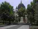
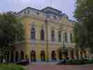
The town is now a destination for foreign and domestic
tourism. Museums, churches, triumphal wells, statues,
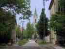
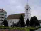
parks, and a thermal swimming hall are notable attractions.

This page was retrieved and condensed from
(http://en.wikipedia.org/wiki/Hódmezõvásárhely)
in July 2005
All text is available under the terms of the
GNU Free Documentation License
(see
Copyrights for details).

2005
You can click on these photos for an enlargement.
 |
 |
 |
 |
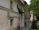
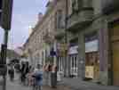
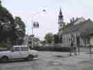
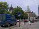
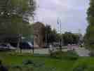
| Hódmezõvásárhely |
Hódmezõvásárhely |
Hódmezõvásárhely |
Hódmezõvásárhely |
 |
 |
 |
 |
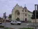
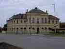
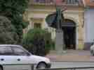
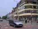
| Hódmezõvásárhely |
Hódmezõvásárhely |
Hódmezõvásárhely |
Hódmezõvásárhely |
 |
 |
 |
 |
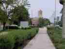
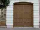
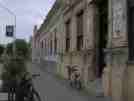
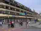
| Hódmezõvásárhely |
Hódmezõvásárhely |
Hódmezõvásárhely |
Hódmezõvásárhely |
 |
 |
 |
 |
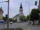
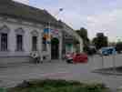
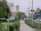
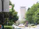
| Hódmezõvásárhely |
Hódmezõvásárhely |
Hódmezõvásárhely |
Hódmezõvásárhely |
 |
 |
 |
 |
| Hódmezõvásárhely |
Hódmezõvásárhely |
Hódmezõvásárhely |
Hódmezõvásárhely |
 |
 |
 |
 |
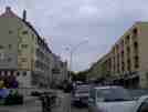
| Hódmezõvásárhely |
Hódmezõvásárhely |
Hódmezõvásárhely |
Hódmezõvásárhely |
 |
 |
 |
 |
| Hódmezõvásárhely |
Hódmezõvásárhely |
Hódmezõvásárhely |
Hódmezõvásárhely |
 |
 |
| Hódmezõvásárhely |
Hódmezõvásárhely |
Hódmezõvásárhely buses
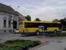 |
| Hódmezõvásárhely buses |
Site Index
Back to Top
Photos Index
Thanks for coming, I hope you
have enjoyed it, will recommend
it to your friends, and will come
back later to see my site developing
and expanding.
I'm trying to make my pages enjoyable and trouble free
for everyone, please let me know of any mistakes or
trouble with links, so I can fix any problem as soon
as possible.
These pages are best viewed with monitor
resolution set at 640x480 and kept simple
on purpose so everyone can enjoy them
across all media and platforms.
Thank you.
Webmaster

|